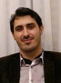


مدیر گروه و عضو هیات علمی گروه عمران- نقشه برداری
مرتبه علمی: استادیار
مقطع تحصیلی : دکترا
دانشکده :فنی مینودشت
گروه :مهندسی عمران- نقشه برداری
|
rokni@gonbad.ac.ir; k.rokni@yahoo.com |
پست الکترونیکی |
| https://www.scopus.com/authid/detail.uri?authorId=54941122100 | Scopus page |
| https://scholar.google.com/citations?user=_HOuPKUAAAAJ&hl=en | Google Scholar page |
سنجش از دور و جی ای اس در علوم محیطی
Environmental Remote Sensing & GIS
ISI Indexed Papers:
1- Rokni et al., 2014. Water feature extraction and change detection using multitemporal Landsat imagery. Remote Sensing, 6(5), 4173-4189. https://doi.org/10.3390/rs6054173. JCR, Q1.
2- Rokni et al., 2015. A new approach for surface water change detection: Integration of pixel level image fusion and image classification techniques. International Journal of Applied Earth Observation and Geoinformation, 34, 226-234. https://doi.org/10.1016/j.jag.2014.08.014. JCR, Q1. *Listed as one of the Most Downloaded IJAEOG Articles from ScineDirect.
3- Rokni et al., 2015. Investigating the application of pixel-level and product-level image fusion approaches for monitoring surface water changes. Natural Hazards, 78, 219-230. https://doi.org/10.1007/s11069-015-1711-0. JCR, Q2.
4- Rokni et al., 2016. A new approach for detection of surface water changes based on principal component analysis of multitemporal normalized difference water index. Journal of Coastal Research, 32(2), 443-451. https://doi.org/10.2112/JCOASTRES-D-14-00006.1. JCR, Q4.
5- Rokni and Musa, 2019. Normalized difference vegetation change index: A technique for detecting vegetation changes using Landsat imagery. CATENA, 178, 59-63. https://doi.org/10.1016/j.catena.2019.03.007. JCR, Q1.
6- Akbari and Rokni, 2022. Spectral-spatial classification of hyperspectral images based on non-linear principal component analysis and deep learning models. International Journal of Remote Sensing, 43(17), 6561-6580. https://doi.org/10.1080/01431161.2022.2142079. ISI, Q2.
Scopus & ISC Indexed Papers:
1- Rokni et al., 2011. Fusion of Aster And Radarsat Sar Data Using Different Transforming Algorithms of Wavelet Resolution Merge. Australian Journal of Basic and Applied Sciences, 5(12), 991-998. Scopus.
2- Rokni et al., 2015. Comparative analysis of ASTER DEM, ASTER GDEM, and SRTM DEM based on ground-truth GPS data. Journal Technology, 76(1), 97-102. Scopus.
3- Hazini. S., Hashim. M., Rokni. K., and A. Shafaghat., 2015. Identifying the Optimum Locations for Food Industries in Qaemshahr-Iran, using GIS and Image Processing Techniques. Journal Technology, 74(4), 153-158. Scopus.
4- Rokni and Gholizadeh, 2020. Investigating the applicability of conventional vegetation indices for vegetation change detection in different environmental conditions. Journal of Plant Ecosystem Conservation, 7(15), 125-140. ISC.
5- Akbari and Rokni, 2023. Spectral-spatial classification of hyperspectral images by combining hierarchical and marker-based Minimum Spanning Forest algorithms. Journal of Geomatics Science and Technology, 12(2), 98-113. ISC.
6- Rokni, 2023. Investigating the impact of Pan Sharpening on the accuracy of land cover mapping in Landsat OLI imagery. Geodesy and Cartography, 49(1), 12-18. Scopus.
7- Rokni and Akbari, 2023. Discrimination of geological units in southern margin of Alborz Mountain in Iran using ASTER satellite imagery. Estudios Geográficos, Accepted. Scopus.
- Rokni et al., 2011. Comparative Statistical-based and Color-related Pan sharpening Algorithms for ASTER-L1B and RADARSAT- SAR Satellite Data. IEEE Conference on Computer Applications and Industrial Electronics, Malaysia. 618-622. IEEE, Scopus.
- Rokni et al., 2011. Performance Evaluation of Global and Absolute DEMs Generated from ASTER Stereo Imagery. IEEE International RF and Microwave Conference, Malaysia. 257-260, 2011. IEEE, Scopus.
| کسب عنوان دانشجوی برتر در مقطع دکتری |
| Best Postgraduate Student Award, 2014, University Technology Malaysia (UTM). |
| Postdoctoral fellowship, 2014-2015, University Technology Malaysia (UTM). |
| Certificate of Most Downloaded International Journal of Applied Earth Observation and Geoinformation Articles from ScinceDirect, 2015. |
| Teaching Assistant (TA) Scheme Award, 2011/2012, University Technology Malaysia (UTM). |
| International Doctoral Fellowship (IDF), 2011/2012, University Technology Malaysia (UTM). |
| International Doctoral Fellowship (IDF), 2012/2013, University Technology Malaysia (UTM). |
| International Doctoral Fellowship (IDF), 2013/2014, University Technology Malaysia (UTM). |